Glencoyne Park, Sheffield Pike & Heron Pike
An excellent adventure on a beautiful day - views for miles and a fantastic start to the New Year!
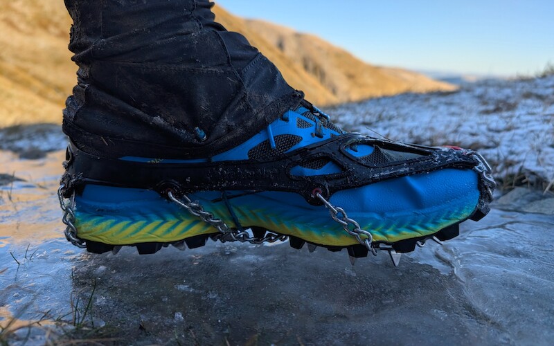
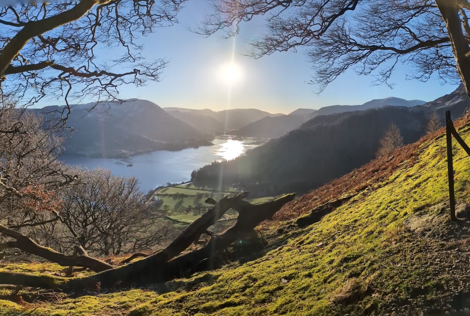
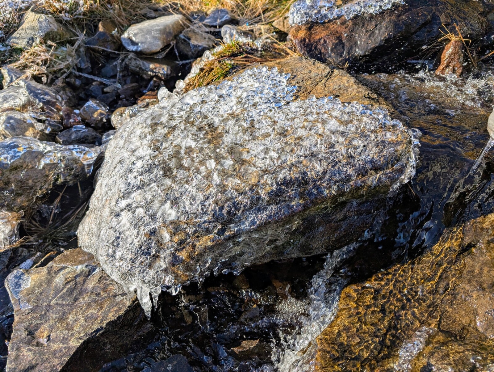
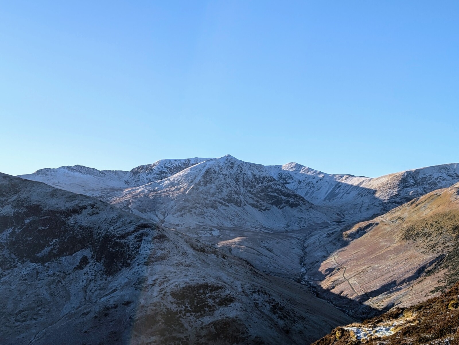
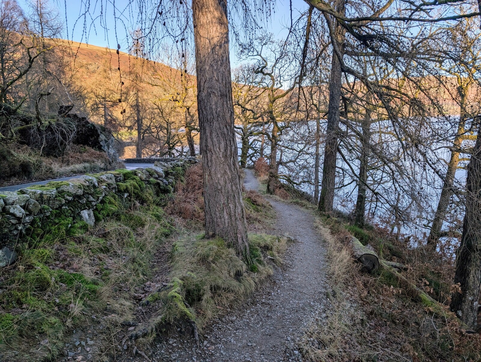
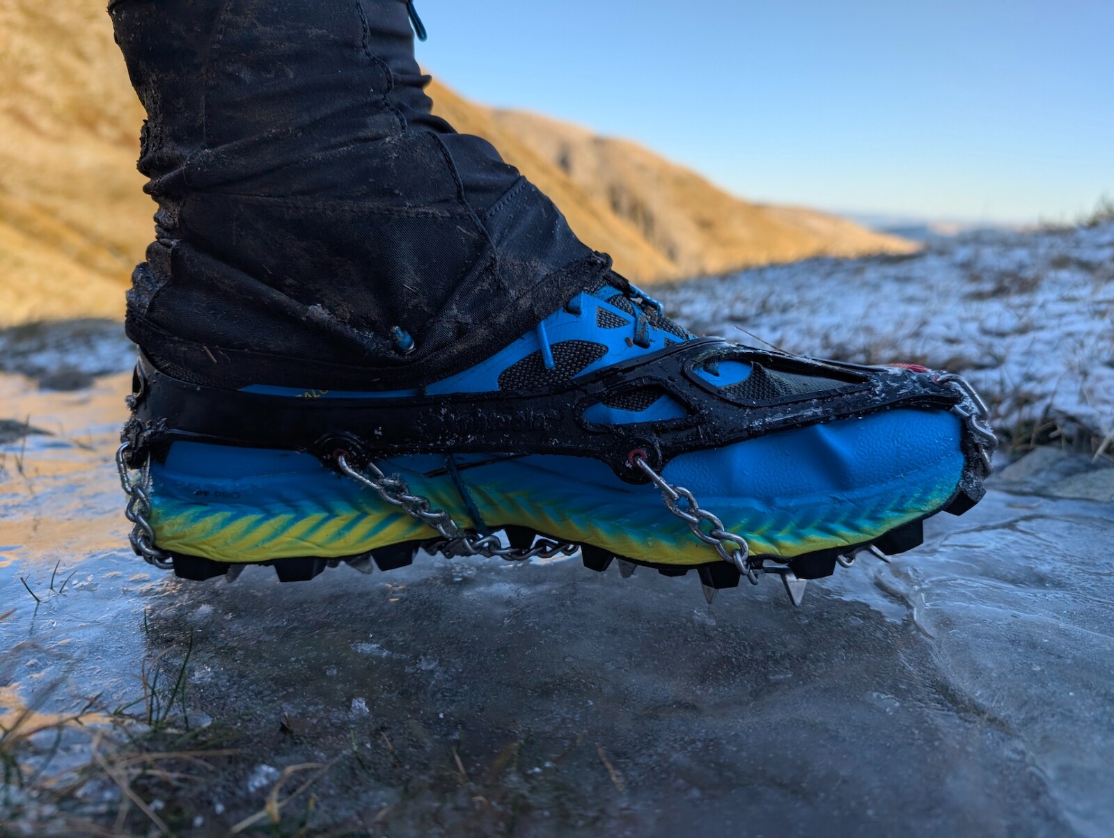
I originally ran the first part of this route along Glencoyne Park on New Year's Day in 2024 and was keen to get out and experience it again on a beautiful, clear day. Similar to last time, there are a lot of becks to cross early on and it's always pretty boggy - the difference this time being there was a lot of ice too so I was glad to have my microspikes for this.
Taking the advice of a lady I passed on the way, I changed my initial route to head up Sheffield Pike and grab a coffee instead of the somewhat trudgy run I had planned back across Watermillock Common as I did last year - this turned out to be an excellent change of plan.
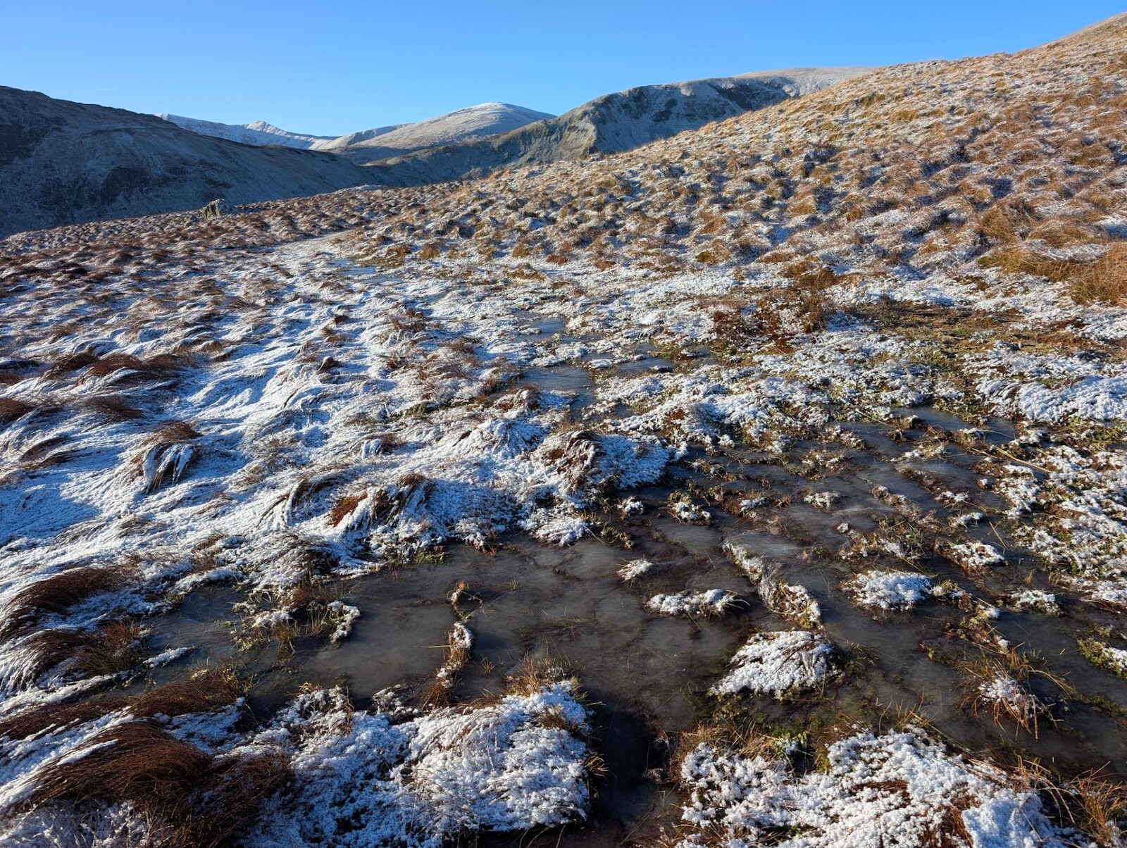
It doesn't really matter where you go in winter - it's boggy when you get up high unless you're on the more well-trodden routes so I was also glad of some neoprene socks I picked up before Christmas as they really saved me having to abandon the walk early on as it was 1°c and even colder higher up.
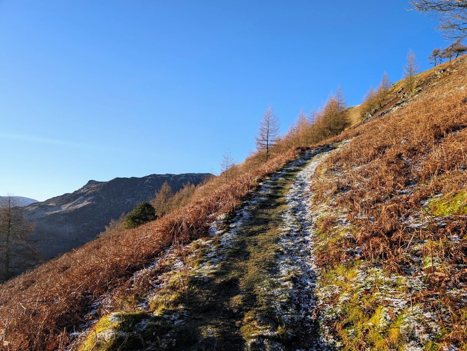
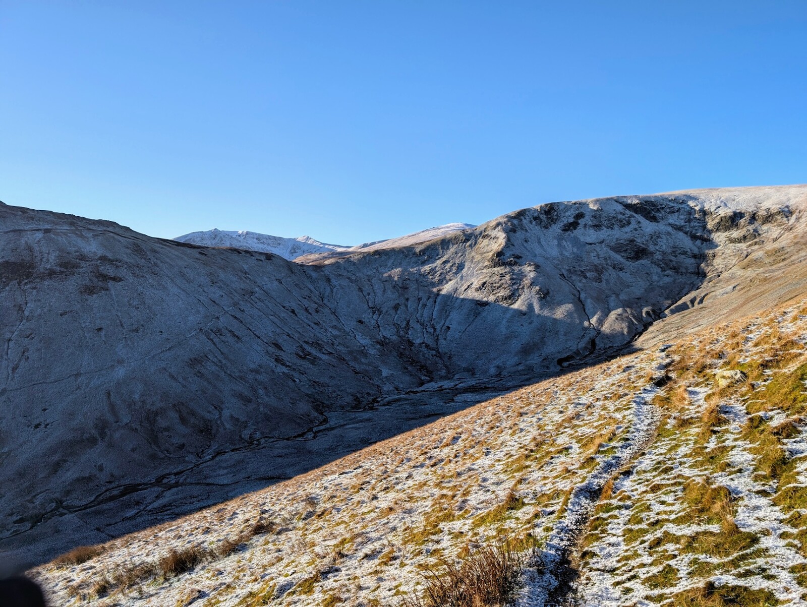
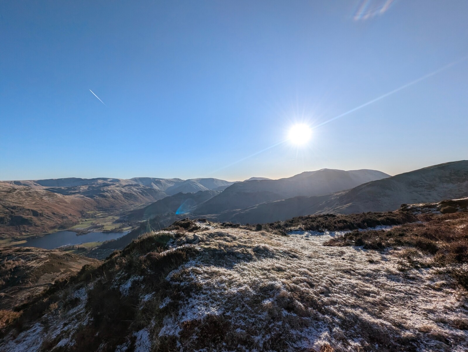
When you reach the wall at the end of Glencoyne Park heading southwest, you can choose to cut it short and head back northeast over Watermillock Common for a shorter outing. The weather was nice today though, the breeze wasn't too cold despite the temperature (I had a lot of gear on by this point though) and my next choice was whether to traverse under Glencoyne Head or head up and over Birket Fell and Hart Side. Given that going up would add on another 200+ metres ascent and I've not been training much at all in 2024, I opted for the lower route although it was hard to tell if I'd encounter scree or not. Fortunately it's a good path, well worn and easily navigable in good conditions, but I was happy with the fact there were alternative routes to head down if I ran into any trouble.
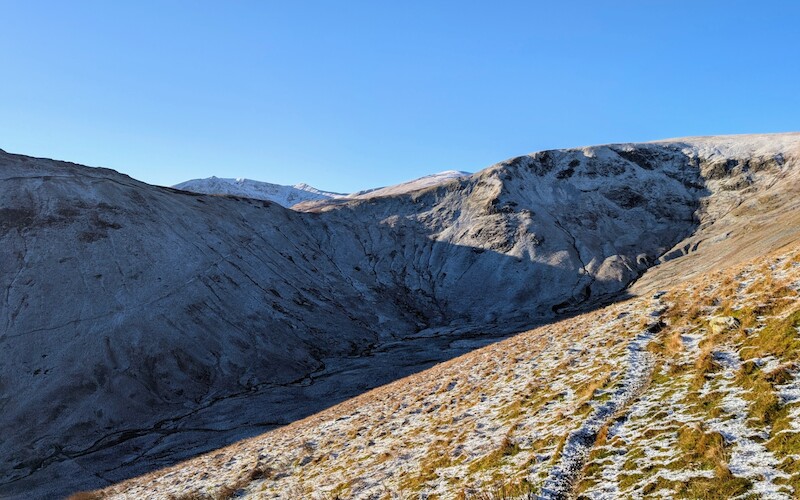
As the path under Glencoyne Head is in pretty much constant shade at this time of year I was once again happy to have the microspikes on - there were definitely a few tricky slabs of ice and other walkers/runners I encountered had to make their way round some sections whilst I enjoyed being a lot more sure-footed on them.
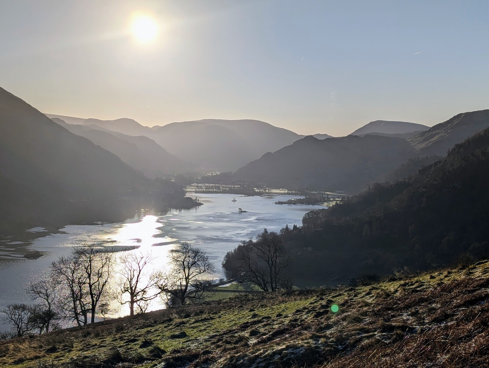
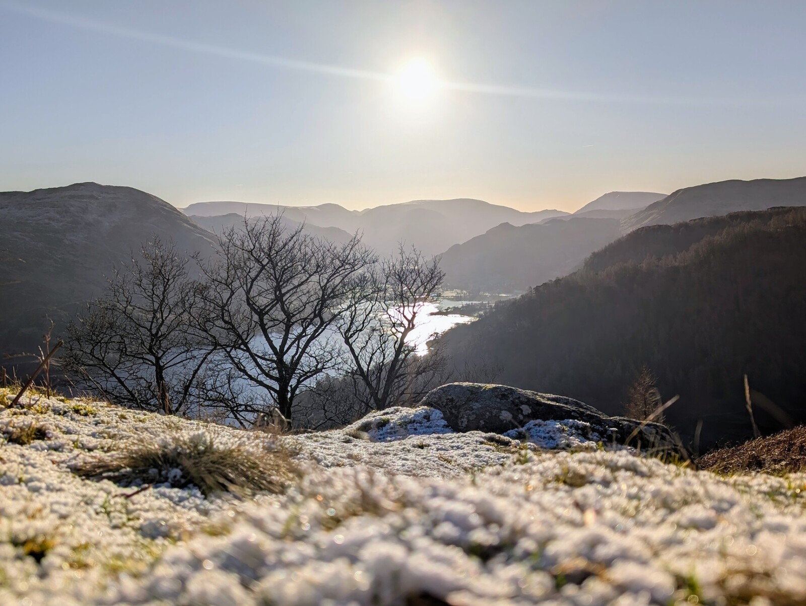
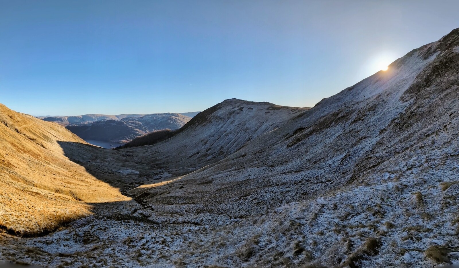
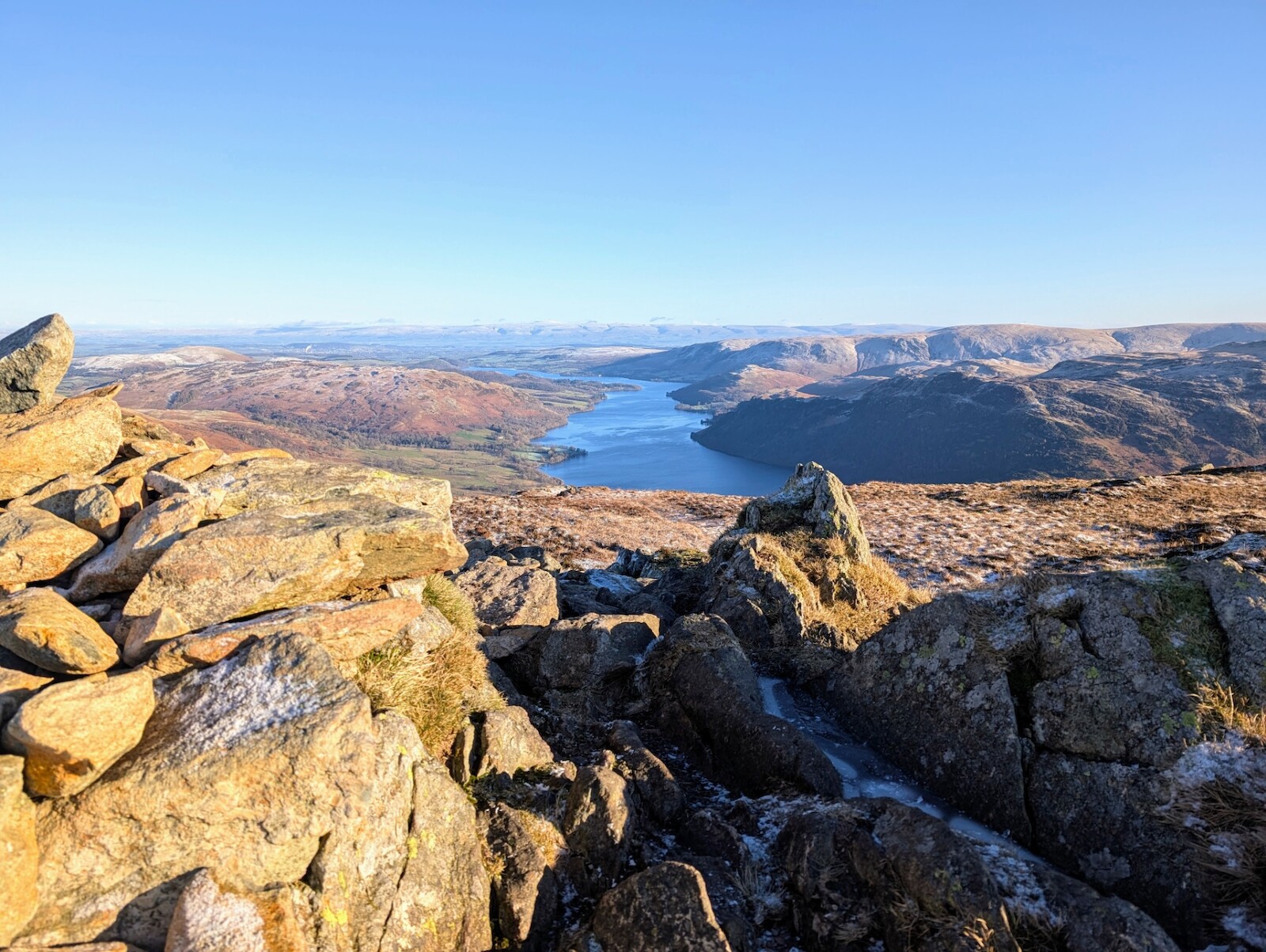
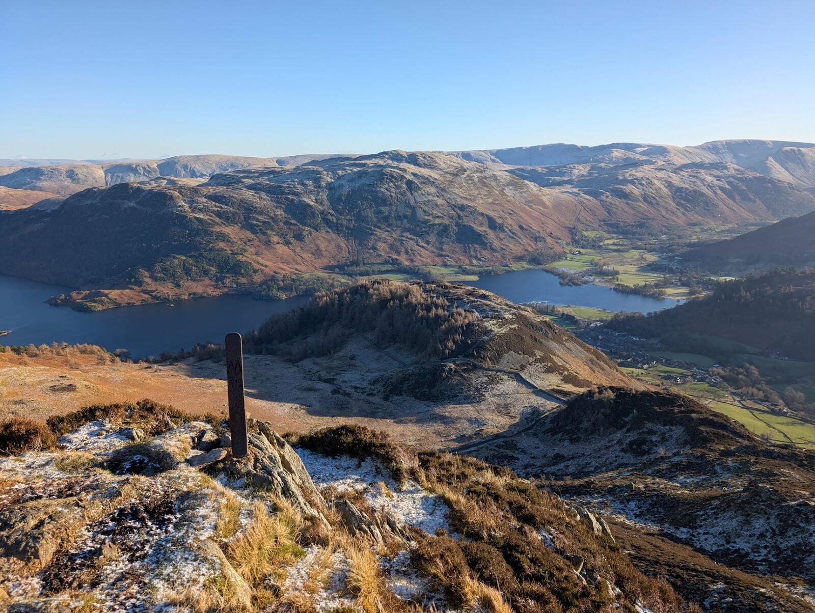
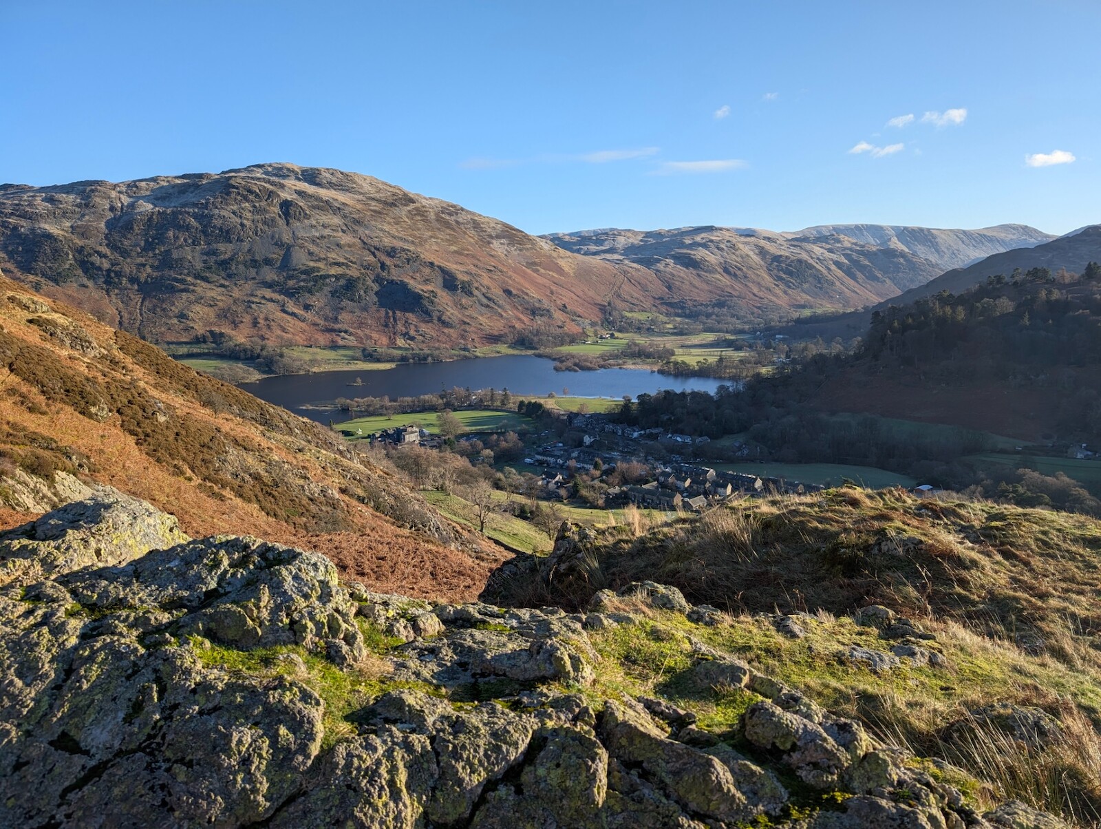
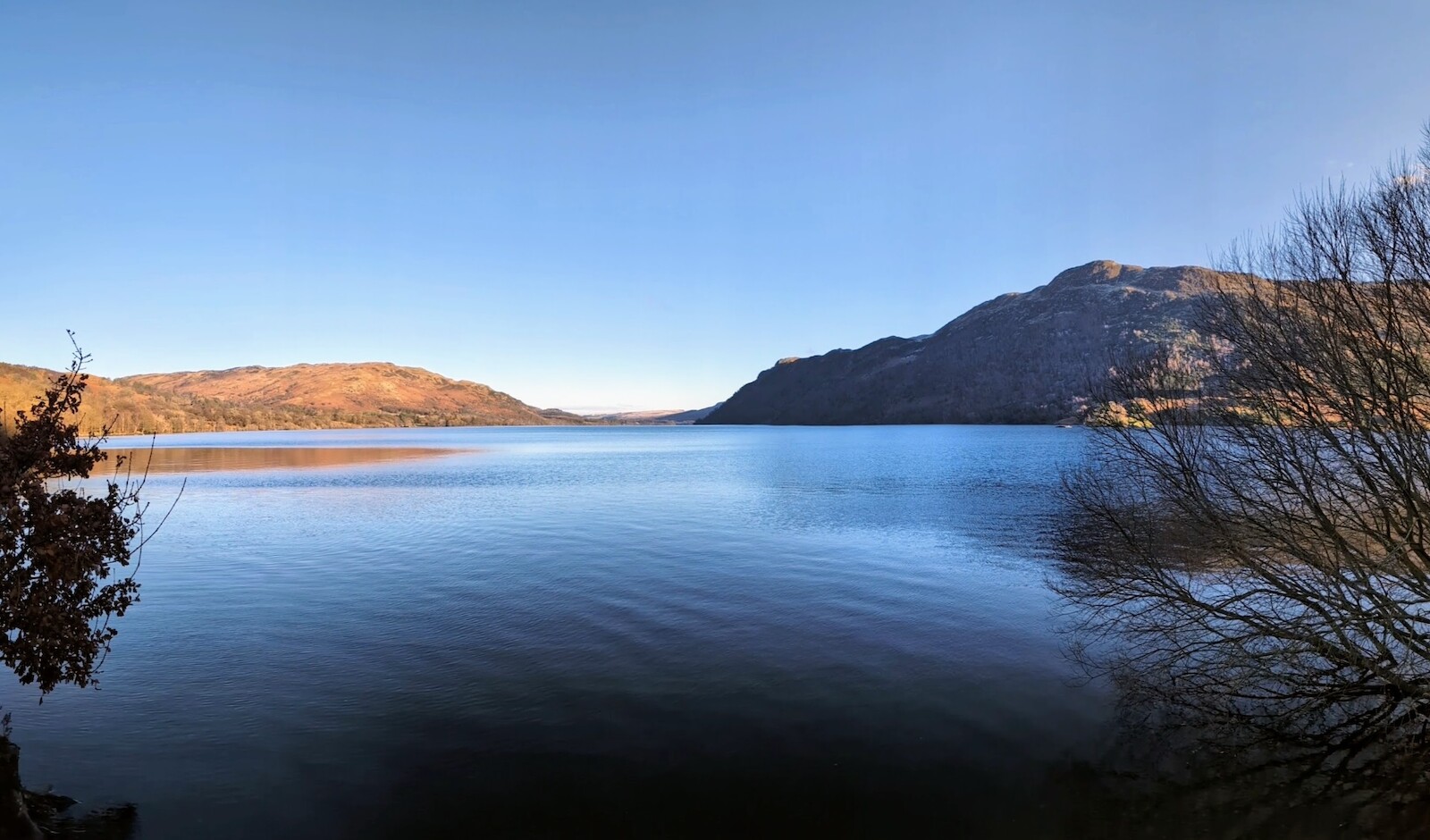
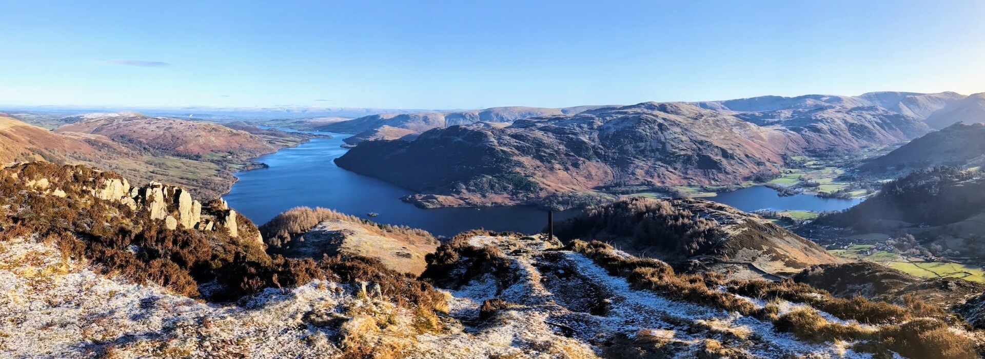
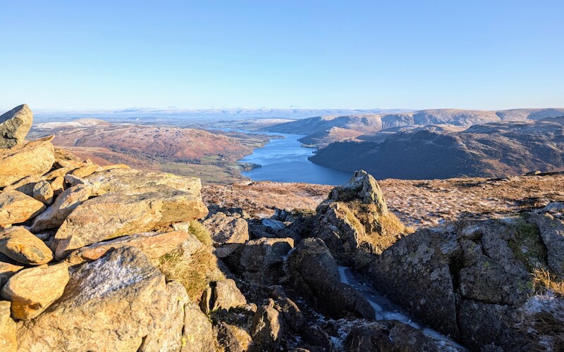
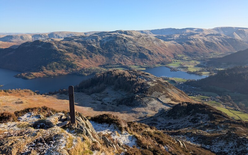
Once I got past this point, it was a bit of a hike to the brow then an easy, boggy, icy (did I mention it was icy? 😆) trek up to Sheffield Pike on the left heading east now. Sheffield Pike always offers stunning, panoramic views of Ullswater on a clear day so is well worth the effort getting there. From here you'll see Heron Pike below (this Heron Pike is actually part of Sheffield Pike and not to be confused with the "real" Heron Pike near Grasmere - a summit is a summit in my book though). It's a bit boggy again on your way down to Heron Pike - and its distinctive metal boundary marker - and another good view. You'll see another hill below you - Glenridding Dodd which you'll carry on down towards over trickier rocky sections until you reach a crossroads when the track goes flatter with a gate in a wall to your left. This is where I could have headed around the north side of Glenridding Dodd but my legs felt good enough to continue on south to Glenridding village itself (and I really wanted a coffee and cake).
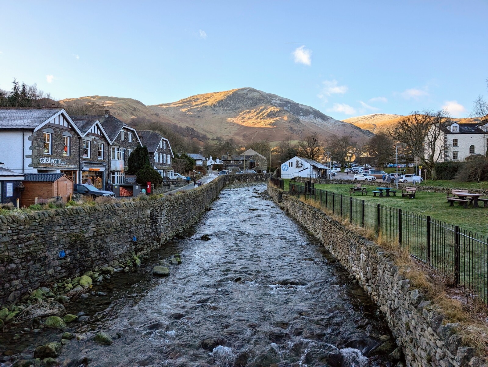
The path to the south here starts off fine and you can see the road you're aiming for below you, but there's a steep bit around a crag that could be slippery to tackle first and then you're down. It's then an easy jog along the road into the village where I was sad to see Helvellyn Country Kitchen was closed until mid-February - but that's fine and it happens as these places rely on tourism and it was pretty quiet out there today. I was a bit sad I couldn't get one of their epic cakes but managed to get a nice coffee from the shop on the corner instead which is well-stocked with food and drink for your adventures.
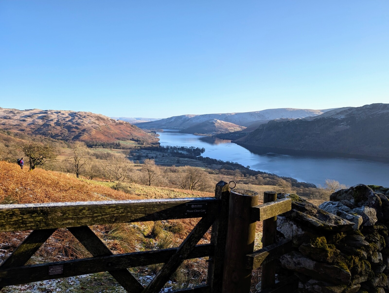
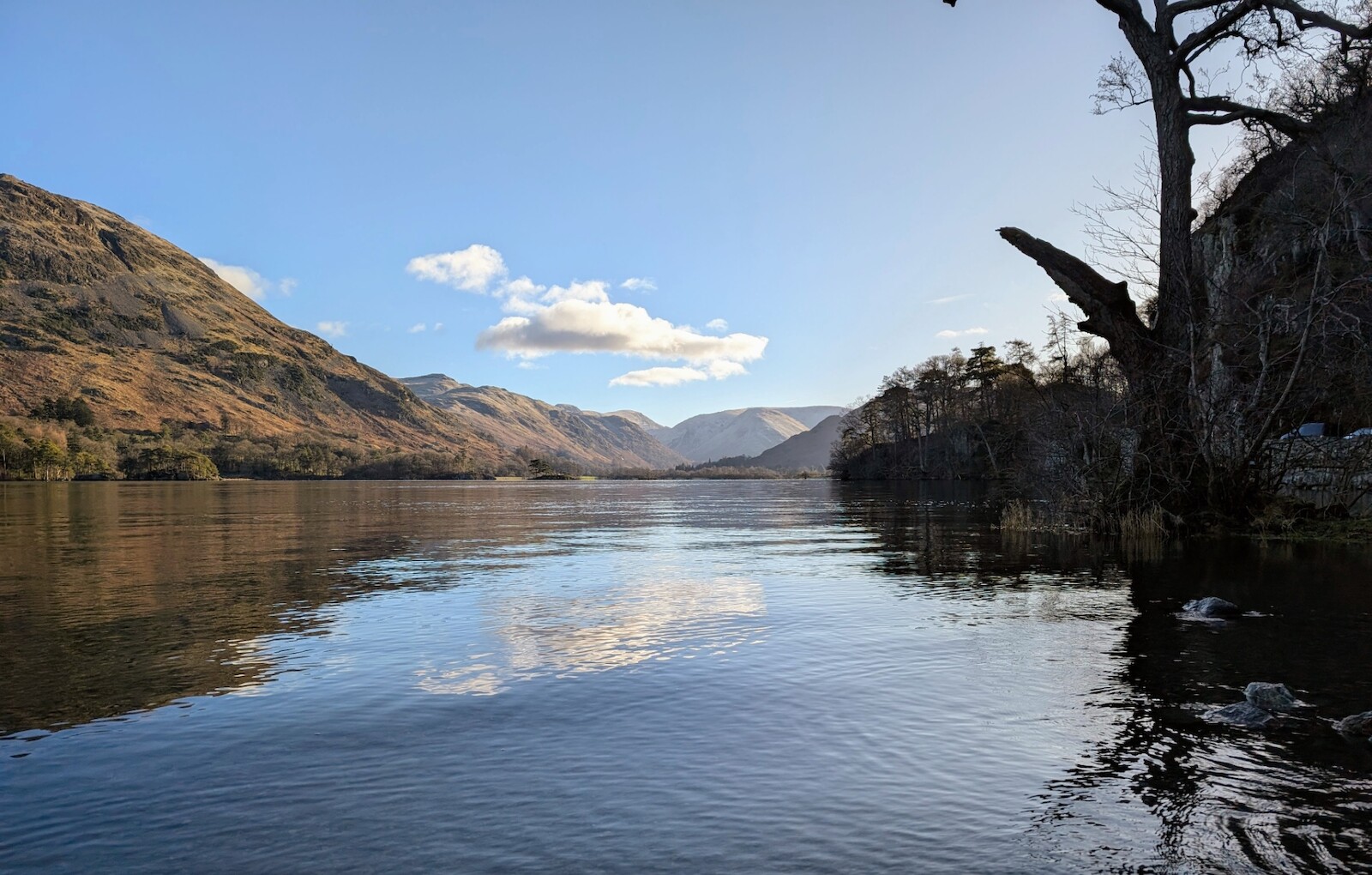
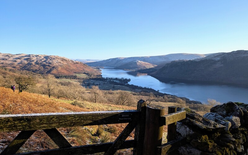
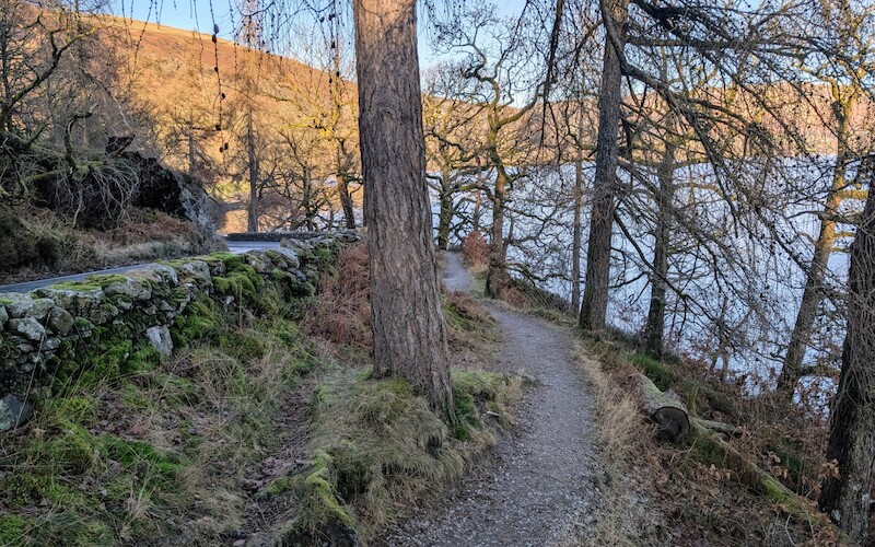
After taking a short break, drinking coffee sat on a wall overlooking the Glenridding Beck (which is more like a river at this point in its journey), all that remained was the much flatter run back to the car. This route follows the road north back to Aira Force but, fortunately, most of it is on paths alongside the road with only a few short on-road sections where they couldn't fit a path in.
Once you pass the car park at Glencoyne Bay, the route heads northeast and you will see a green path on the map that looks like a shortcut back to the start. I took this today and wouldn't recommend it (it was fairly undefined, really boggy and at one point I had to jump over a fence into a knee-deep puddle as a gate was tied shut - I'm 6 foot 2 so that was pretty deep and I was glad of my neoprene socks!). Instead, I've altered the route to the main Aira Force car park which is a much nicer way to get back to Park Brow car park as you just do the easy walk up through the woods and can take in Aira Force itself on the way which never fails to impress. Once you're at the bridge at the top of the waterfall, you just head west back to the car park.
All in all it's a great route and I'd done various bits of it on different walks before but it was nice to join them up today and take in the scenery.
I've linked a few car parks for this walk as it's a popular area, but there are also some spaces along the road towards Glenridding or you can use the car park in Glenridding itself as the walk is a loop - I just prefer to finish nice and easy on the flat and was up early enough that there were plenty of spaces. Something else to bear in mind is that parking near Aira Force is quite expensive past the first few hours, but if you're a National Trust member it's included in your membership.
In terms of gear I had nice, grippy trail shoes which helped once I took the microspikes off lower down (they have a rubber upper and just stretch over your shoes) which were great for tackling more mud and some of the more rugged rocks. I also had a warm mid-layer fleece and thermal running leggings which are my go-to when it's sub-zero like today (as I've said it was 1°c at the start, so add on a few hundred metres of elevation and a light breeze and it must have been more like -2°c in places). I always take more than I need so had gloves and over-mitts along with extra layers in my pack along with a first-aid kit and survival bag - both of which take up very little space and are sensible when you're out on the fells in the Lake District whatever the weather as each valley seems to have its own micro-climate and the weather can roll in very quickly.